
Avionics
Batteries
Books & Videos
Charts
Composite Materials
Covering Supplies
Electrical
ELTs
Engine Parts
Flight Training
Flight Planning
Gifts
GPS
Hardware
Headsets
Instruments
Landing Gear
Metals & Plastics
Pilot Supplies
Radios
Tires & Tubes
Tools
Wood Products
Kits & Plans
FBO Supplies
Liqui Moly AERO
Catalogs

Enroute Low Altitude Chart L-3/4
| Part number: | 13-05186 |
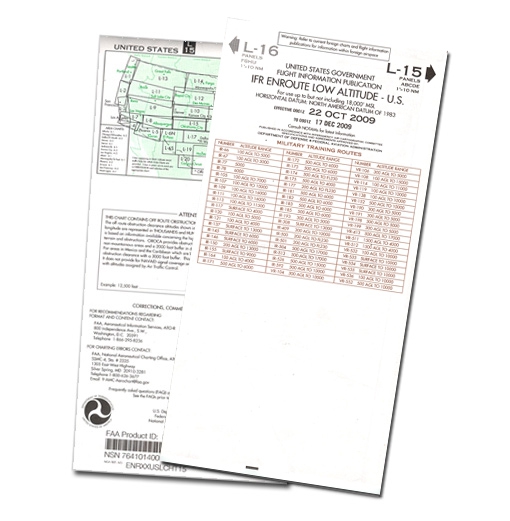
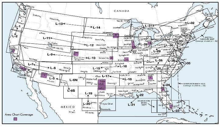

Enroute Low Altitude charts (Conterminous U.S. and Alaska) provide aeronautical information for navigation under instrument flight rules below 18,000 feet MSL. Information includes: airways, limits of controlled airspace, position, identification, and frequencies of radio aids to navigation (Alaska 4-color series includes geographic coordinates), airports with terminal air/ground communications, minimum enroute and obstruction clearance altitudes, airway distances, reporting points, special use airspace areas and military training routes. Scales vary from 1 inch = 5nm to 1 inch = 20nm. Chart size is 50 x 20 inches (5 x 10 inches folded). Charts are revised every 8 weeks.
KEEP YOUR CHARTS CURRENT WITH OUR SUBSCRIPTION SERVICE!Take the hassle out of remembering to re-order new navigation charts at every revision by signing up for chart revision service with us. To order a subscription, put a quantity of 1 in the Subscribe column for each chart you would like the subscription for, then click the "Add to Cart" button at the bottom of the table. Once in the cart, you will be asked if you would like the current chart now, or start with the next revision. You will then recieve the new editions of each chart automatically when they are issued indefinitely until you cancel the subscription. Your credit card will be billed when we ship you each new chart. Count on us for all your navigation chart requirements!
| Unit | EA |
| Hazardous | No |
| Oversize | No |
| Weight | 0.068 kg |
| Manufacturer | |
| Manufacturer P/N | |
| GTIN | |
| Core Charge | Yes (add to cart to see price) |
| 110V device | Yes |


 | Call us at +49 7634 9057700 from 08:00 to 13:00 CET |


